There are three parking areas for the Plotter Kill Preserve. The Mariaville Rd trailhead allows you to stay more or less on level with the valley rim and is the most accessible section of the trail for folks with different mobility levels and also affords them views of the upper falls. The Lower Gregg Rd trailhead provides access to the Northern section. I can't speak to the trail's accessibility there, but I doubt it's great, though it does provide a flattish hike for folks who want it.
We went to the Coplon Rd trailhead which immediately drops you into the valley for a more challenging experience. There were a couple of cars at the lot when we arrived at around 11:30am.

We went to the Coplon Rd trailhead where there were a couple of cars at the lot when we arrived at around 11:30am. We started our hike a few minutes later with Sunny pulling me along with gusto.

After a short hike downhill, this part of the trail splits. To the right (East), you can stay on the rim of the valley. To the left (West), the trail descends into the valley floor for a more challenging and tactile experience. We turned left.
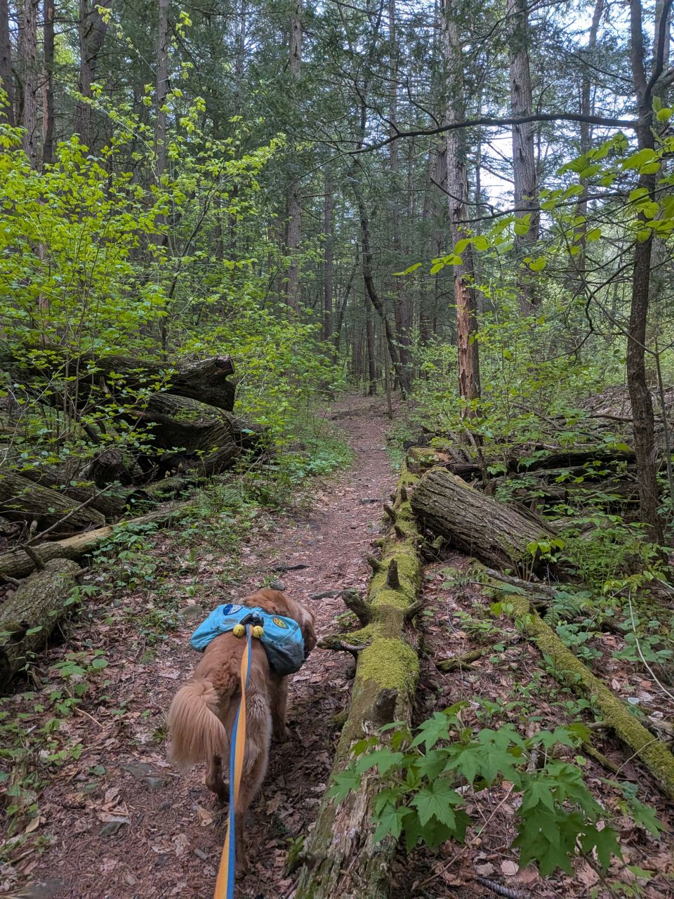
The downhill portions of the trail are a bit rocky and rooty as you'd expect and the flatter portions in the more rugged sections of the trail are smooth and earthy. We moved along quite quickly along the well-marked and well-maintained trail.

There are several options to cross the Plotter Kill over to the trail on the other side, but I wanted to see some waterfalls, so we headed Northwest.

There was a lot of water moving in the valley today, but the crossings were definitely passable. It was a very pretty day and the trees and flowers were certainly showiung signs of life.


We eventually came to a place where we could either follow a herd path to the base of the lower falls or climb up to the viewpoint on the rim. I chose to stay on the trail for now. The climb up and down here is assisted by both wood stairs and cables. The valley here on both sides is very steep, so this is a pretty good idea.

This is the view of the lower falls from the balcony at mid-point of the climb.


We crested the ridge and jumped on the blue trail. This is a very accessible trail with a lovely viewpoint for the upper falls. It's not the greatest view, but it must be a great place to pull up for a restful think after a tough day. Even at this distance, the world is full of the sound of rushing water. Any road noise that might otherwise intrude on this place is completely obscured by the waterfall's roar. Ostensibly, there's a bridge at the end of the blue trail, but we took a herd path across the stream instead.

The falls looked awesome from above. I had to get down there, but it was far too dangerous to descend the shale scree at this location.

I cut Sunny loose for a bit on the red Northern rim trail. This trail is very well-maintained, but more rugged than the Blue trail. As we hiked along, I looked for spots where it'd be safe to descend. If I'd paid attention to the map, I'd have seen there was an actual trail to the valley floor a quarter mile from where we'd come up. I should have taken us that way instead.

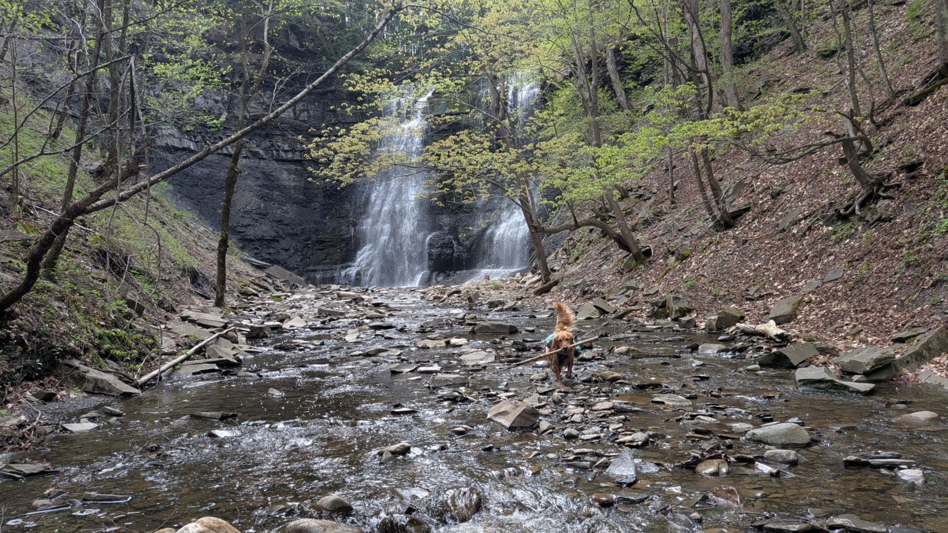
We descended to the valley floor to the upper falls herd path without incident. With all the loose shale here, it was actually a bit of a bad choice to do this. It wasn't unsafe, but I did knock loose some scree. Granted, this is how the valley was formed by water for millions of years, but it didn't need my help.

There's actual trail up and down the side of the valley, but there was no reason for it today. We simply hiked rock-to-rock in the stream. Sunny ran around having the time of his life. I'm pretty sure it was, by his estimation, the best place he'd ever been in his life.

The only way I could get him to pose for this shot was to hold a stick before throwing it. We played fetch here for a long time and Sunny could have kept on doing it forever.

The base of the falls was exhilarating. The bowl was wide with sheer cliffs here, here implying that, further down the valley the walls had had more time to erode and fill in.
This part of New York used to be under an oxygen-starved, bowl-shaped sea. Aeons would pass, filling the bottom of the sea with layers and layers of microscopic sediment creating the bands of shale. Every once in a while, the formation of the Taconics would cause massive slides of sand and mud, creating the bands of lighter-colored sandstone. The diversity and number of fossils here are relatively low because of the low-oxygen nature of this ancient sea.
After rising above sea level and years of erosion, the Plotter Kill has slowly eaten away at the softer, less stable shale, creating ledges of sandstone which eventually crack and break away thanks to both gravity and ice expanding.

"Good thing I can't read."
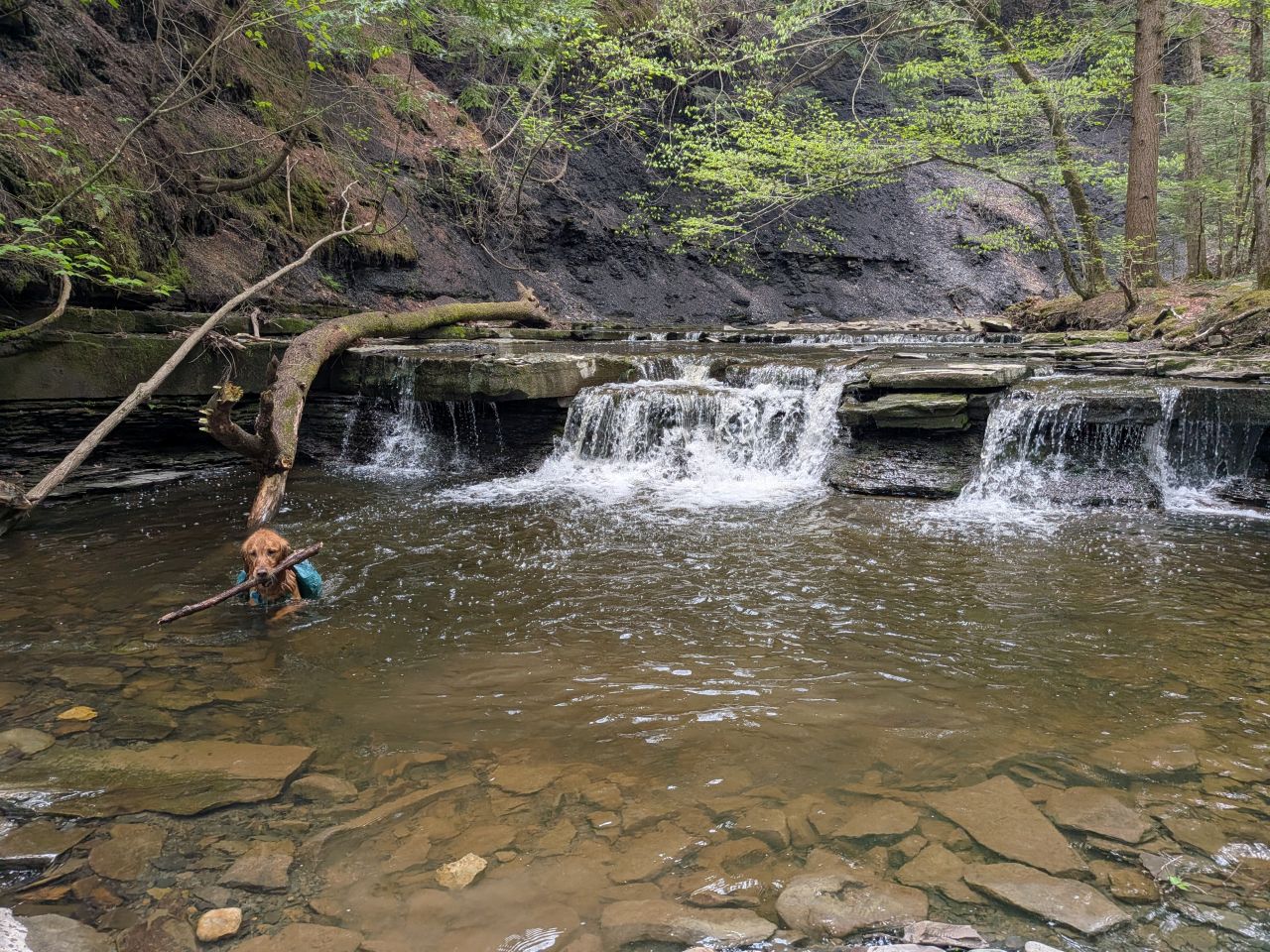
After a time, I begrudgingly pulled Sunny from his fun and we headed back East along the stream until we came to the top of the lower falls. We played a little more fetch in the pool here before heading up the yellow spur trail we should've taken earlier.

The trail along the ridge descends into a little valley after a junction with a trail called the "Highland Trail". We turned right and crossed the Rynex Kill near the top of that brook's falls. This crossing was cool because it was over a part of the brook that rushes over a flat slab of sandstone. Best be careful here because wet sandstone can be slippery as hell and the drop not 20' away is probably deadly.
After this, we came across a group of dogs and their people. We let the dogs off leash for a short romp while we chatted about the trail. As usual, the people we met today were awesome.

We unsurprisingly found our first Red Trillium of the year.
When we got to the valley floor again, I though about taking us back upstream to see the lower Plotter Kill falls and the Rynex Kill falls, but I decided to take us home instead. We could (and will) come back again someday to have a fresh look. I'm definitely excited to come back in the winter to see the kind of incredible ice structures that form on the falls.
Route Map
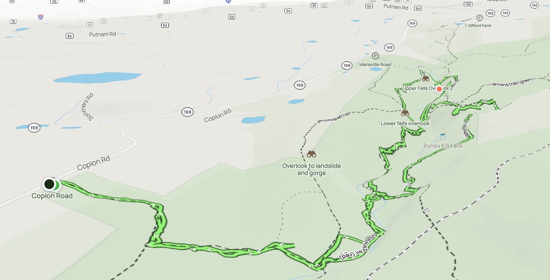
Plotterskill_Falls_.gpx (118.68 KB)