Drizzly Start
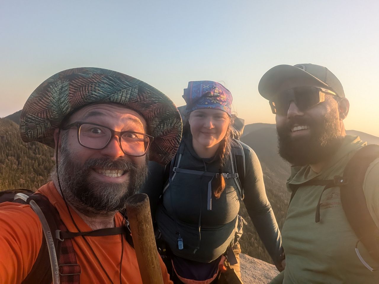
Nick picked me up at the park & ride a bit after 4am, putting us all together at the Garden Trailhead a bit after 6am. As you may recall, the easiest way for a dog to achieve Sawteeth is via Gothics from the Garden because the AMR is the worst. Since Sunny and I have been up the Phelps and Orebed Trails several times, I will forego any detailed descriptions of these routes in lieu of anything unique to this trip that might be of interest.
Thanks to both Charissa and Nick for providing me with additional photos for this post.
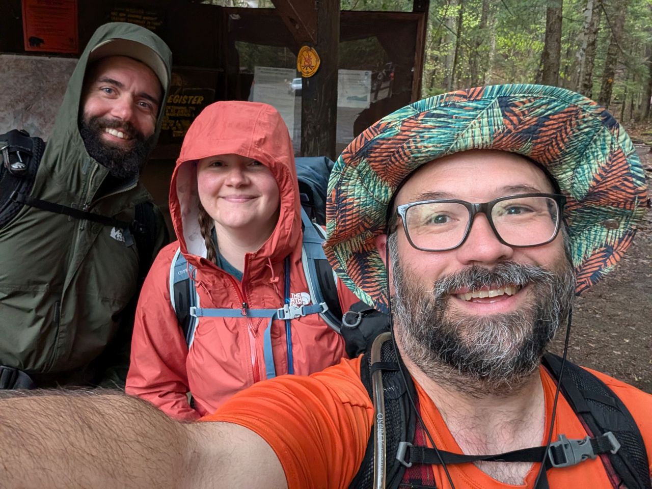
We did have to wait around for a bit so that some weather would pass us, but we got signed in by 7am. We were all chatty and in great spirits.
As usual, Sunny decided to do a poo a few minutes into the hike. I told Nick and Charissa to keep going while I dealt with it and I'd catch up to them at the next intersection. Shortly after they left, thunder rolled in the West. I got the poo buried and hurried along. A couple of hikers who had started before us were trotting back to the trailhead to ride out the storm.
I saw a boulder with an overhang and decided to go with that instead. A car would certainly be safer, but I didn't want to get caught running a quarter mile during a thunderstorm. I detached Sunny from me and dropped my gear, then stood, crouching, in the lee of the boulder. Soon, the thunder was louder and closer. Rumbles passed to the North, then eventually faded into the Northeast.
We met back up with our friends shortly after and made quick work of the remainder of Phelps Trail to the interior trail register. We hadn't gotten terribly wet from the rain, our shell layers having deflected the majority of it.
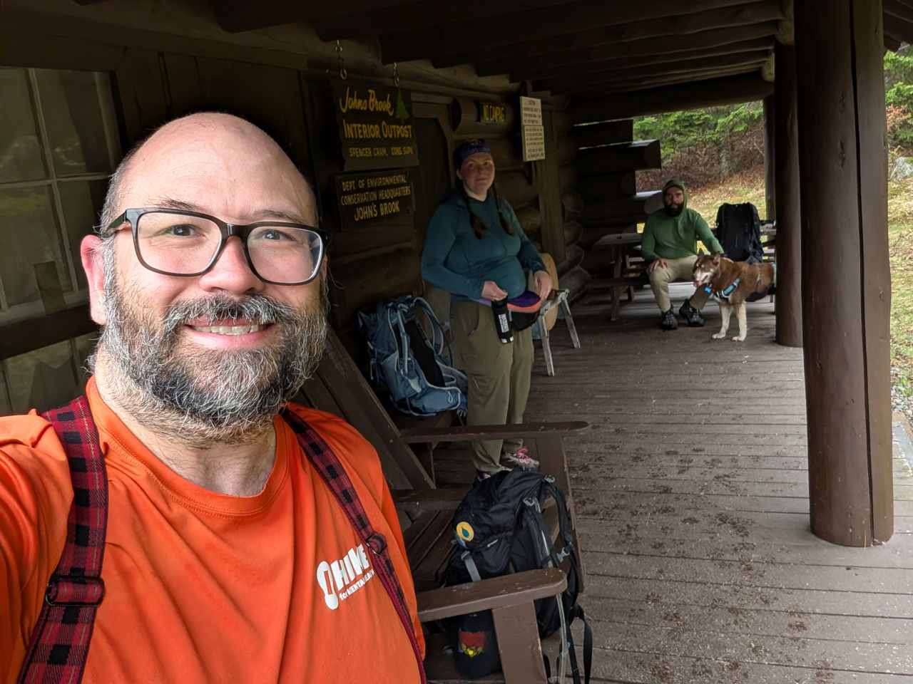
It was 9am when we reached the John's Brook Interior Outpost. It was a little later than we'd hoped, but staying safe from the weather was worth the delay. We took care of our necessary tasks and were soon on our way.
Splish Splash up Orebed
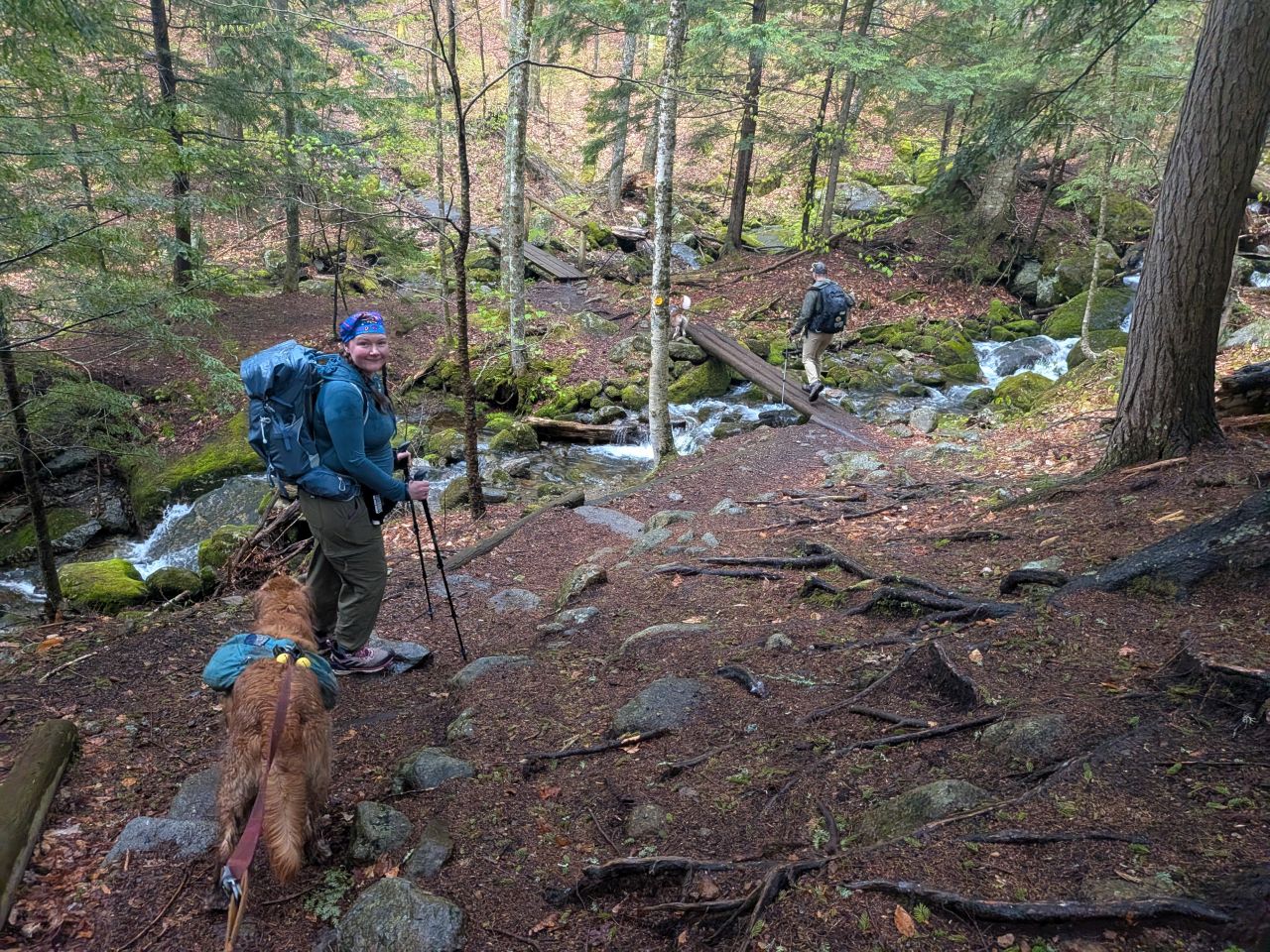
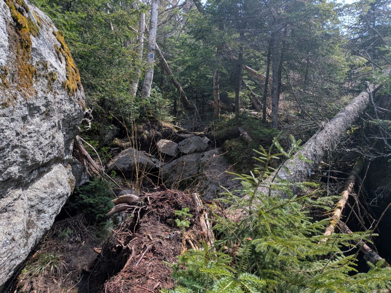
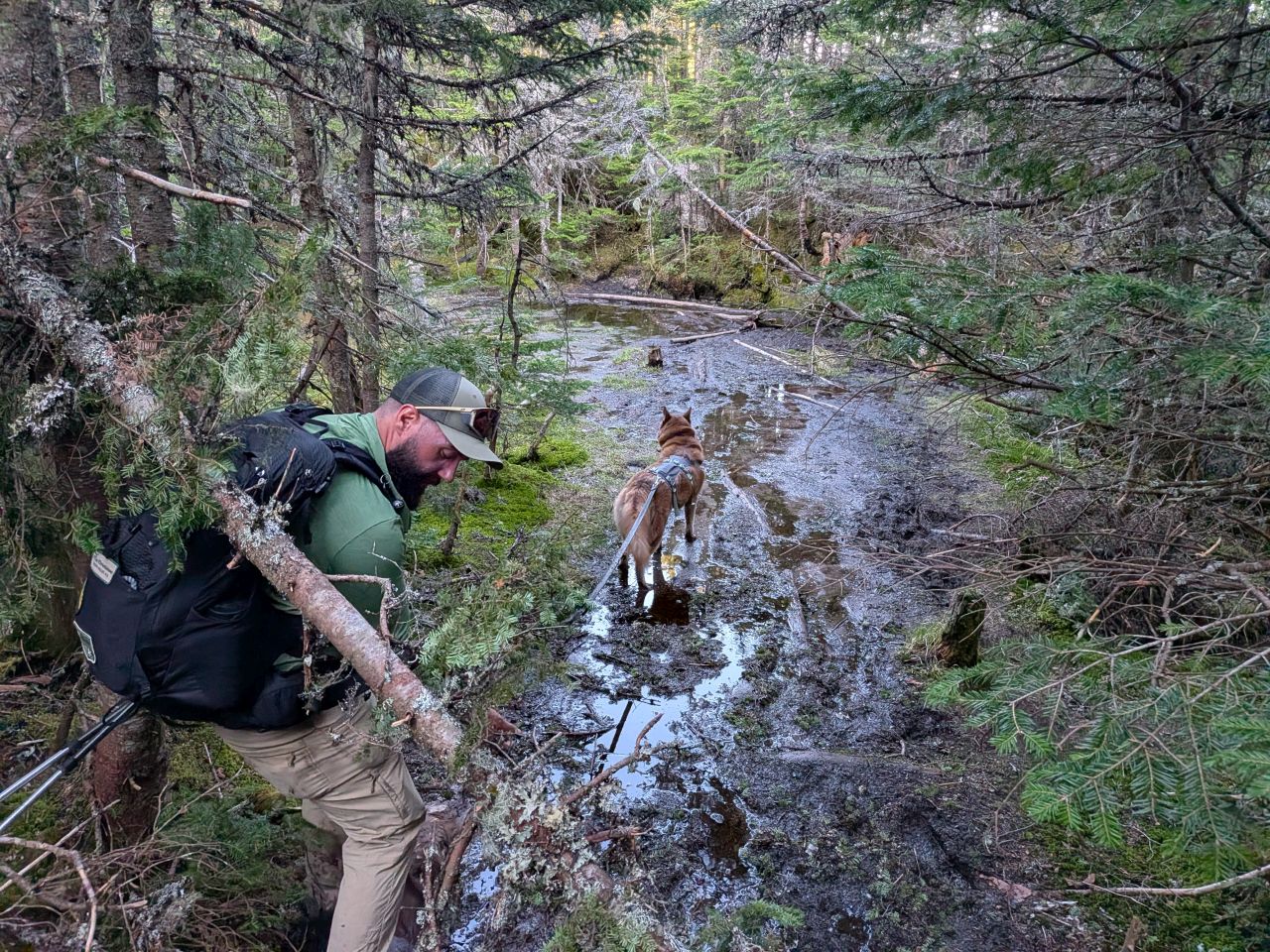
It was clear that the section of the Orebed Brook Trail from the Southside junction to the Woodsfall junction was never easy. It is a very deep and wide rut full of rocks and standing water. It's clear that this trail was heavily used for decades before I was born and has been used heavily since. It does not feature any of the trail improvements that are apparent for Orebed Brook Trail past the Woodsfall junction. This isn't too much of a surprise considering most people probably just hike into the JBL, then cross the brook via Woodsfall before heading up Gothics or Saddleback.
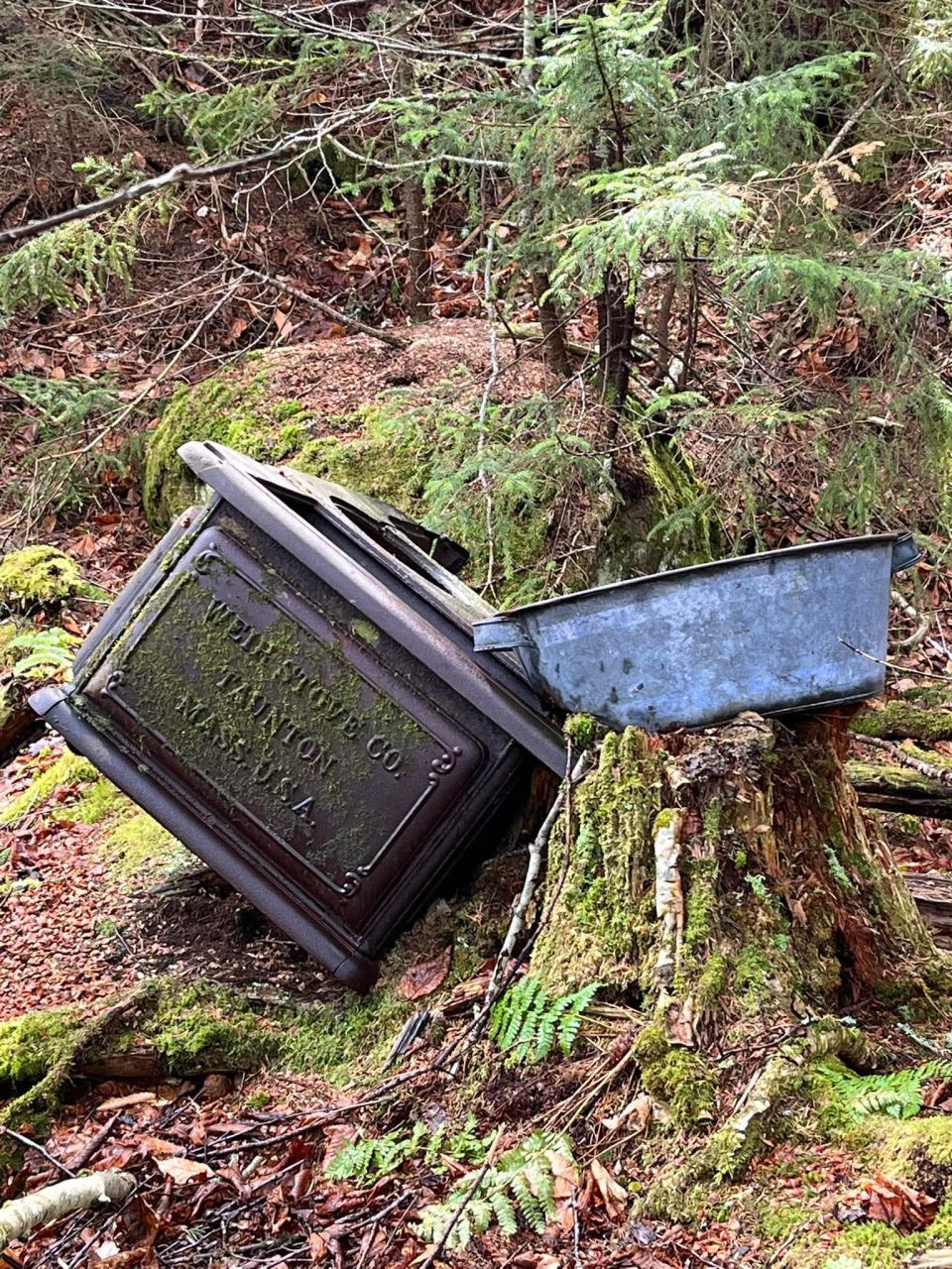
Unfortunately, I led us down a wrong trail almost immediately. We meandered nearly a quarter of a mile down a spur trail to a brook crossing near Grace Camp on the opposite bank. We turned around and headed back to the marked trail, but not before Charissa got a photo of an old cast-away stove.
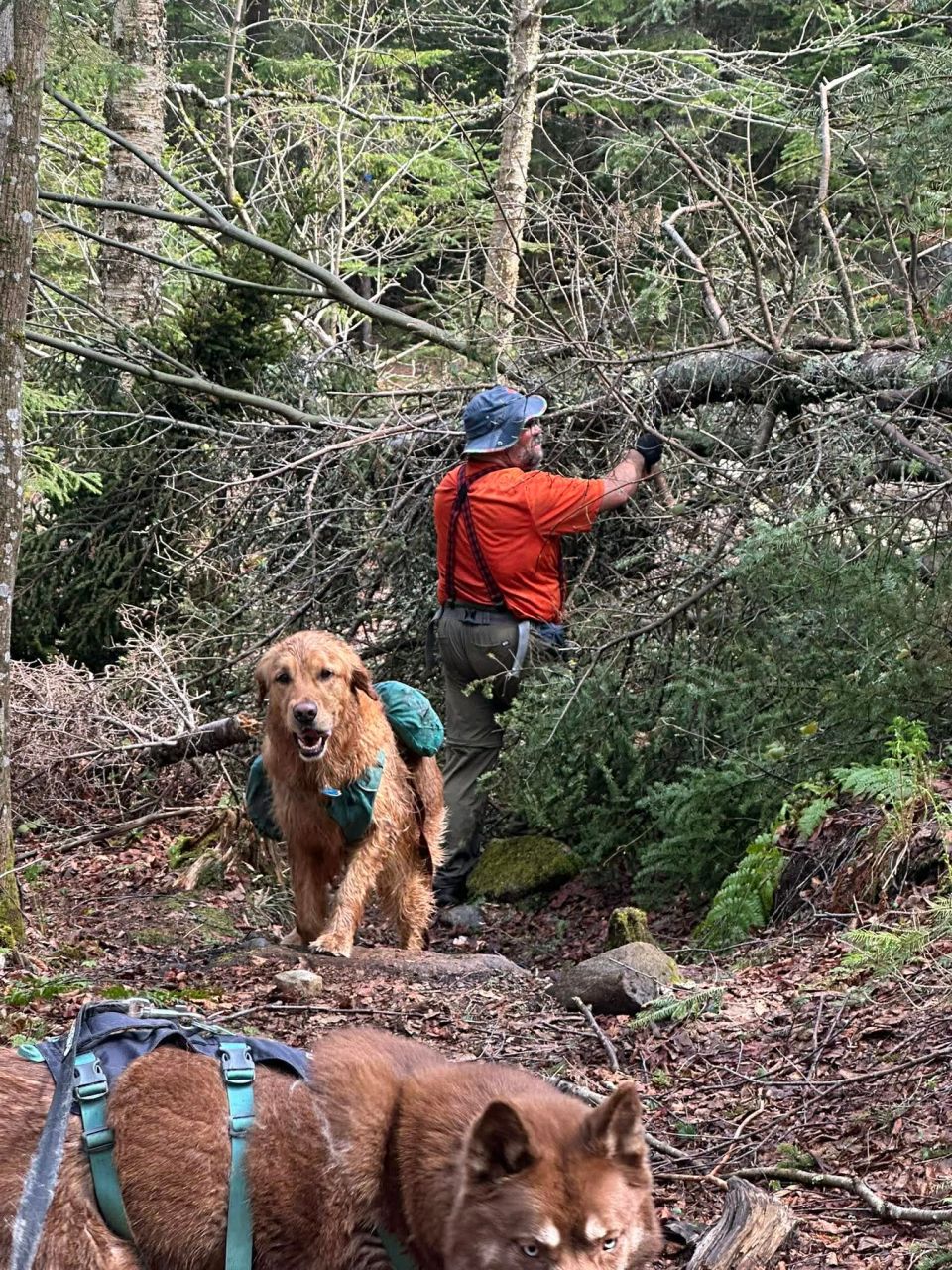
We arrived at the Orebed Lean-to at around 10:15 where we took a break to potty, eat, drink, and troubleshoot Charissa's new GPS. There was also a couple of trees down along the trail. Since I had my saw on me, I decided to clear it away since we had time.

Charissa took this shot of Nick and Stella passing the massive, characterful boulder that I've admired in the past. Shortly after, we stopped at the crossing just before the climb begins in earnest. Here, we all refilled our water. I'd left two bottles empty, but now I filled them and also left my BeFree full of water. It would be a big day and we had to make sure we had enough water for the challenge ahead.
The Big Climb to Pyramid
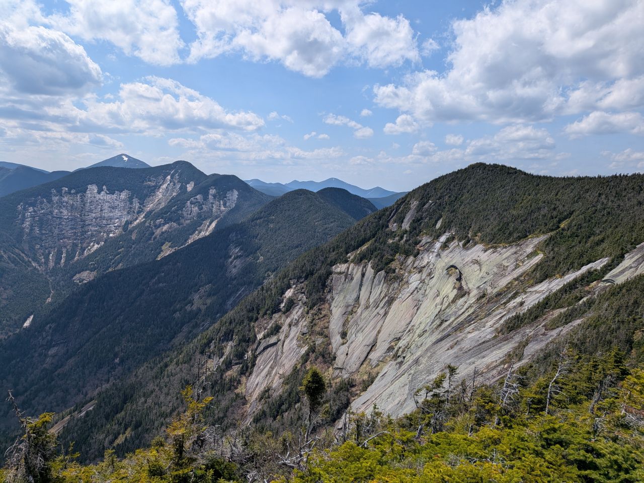
As usual, the trail at the bottom of the Gothics slide was a disaster. This is not really all that surprising; the bottom of the slide is just piles of spoil where the woods are trying to claw back to life. Today was literally the first time I didn't get lost wandering around through here. My success had more to do with my memory of the location than the clarity of the trail. This whole section could stand to have more blazes and other infrastructure here to keep folks on course.
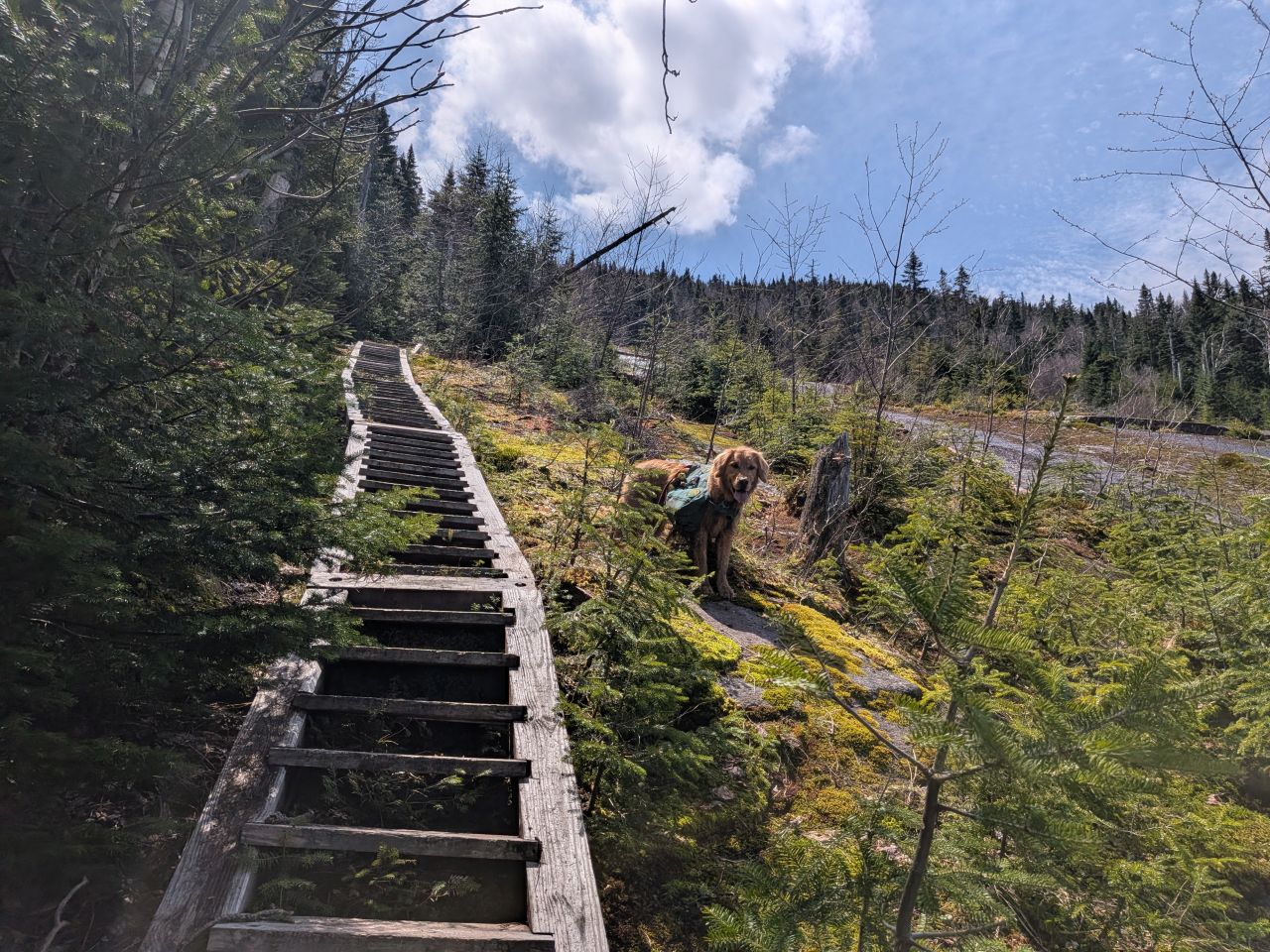
Sunny and I climbed up the Orebed Brook Trail stairs for the fourth time and probably not the last time. The woodsy section after the stairs was just as endless as I remembered it.
We'd cleared the Orebed/Range junction and started climbing the upper slabs by 1pm. I warned Nick and Charissa that I thought our finish time was pushing out closer to 10 or 10:30 instead of 8. We decided to play it by ear and make a decision when we hit the South shoulder of Gothics.
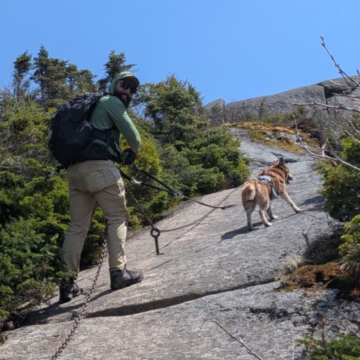
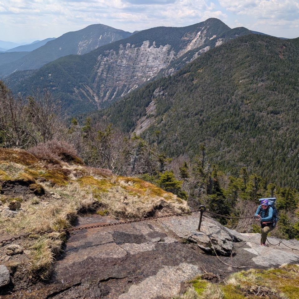
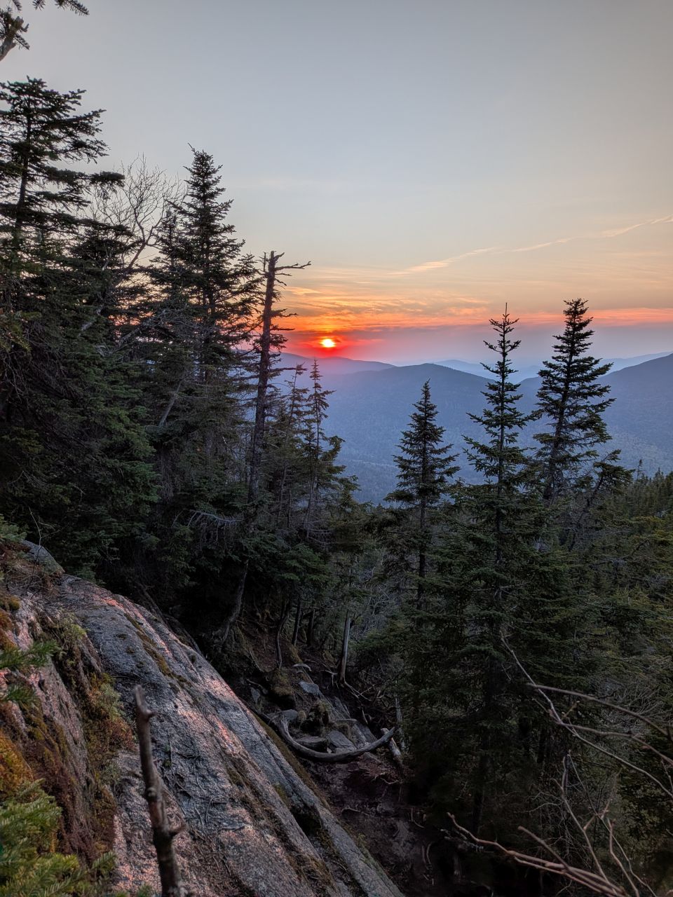
The big climb had finally come and we tackled the cables. All of the hoses have been removed from them, so now they're just long lengths of chain. Anyone coming up this route should probably be wearing gloves anyways. Nick and Charissa did admirably on these steep, challenging, and sometimes scary slabs. Despite all that, the sun was now dominating the blue skies overhead, and we were rewarded with glorious views every step of the way. I was glad I'd filled up to the full 6 liters of water because I drank two between where we'd filtered and the summit.
We achieved the Southern shoulder overlook on Gothics at around 1:35. In retrospect the math was just not mathing on a 10:30-11:00 finish time. The time was considerably later at this point than it had been the last time Sunny and I had done this, to the tune of about three and a half hours. I'd gotten to the car at 8pm after that hike which would make sense if we were going back down Gothics instead of hiking the rest of the range. But we were full of piss and vinegar and pressed on.
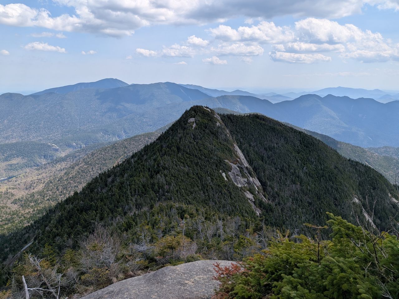
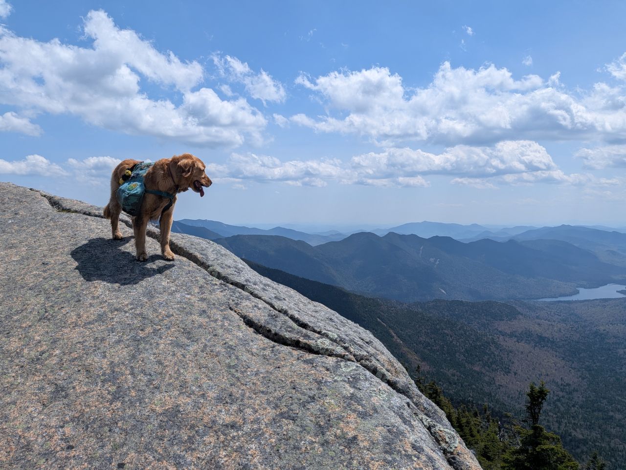
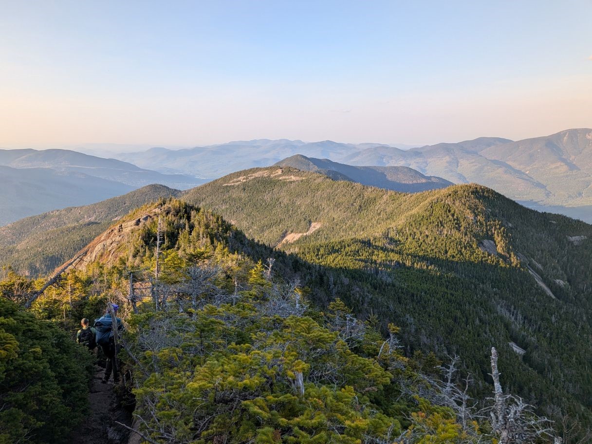
Pyramid loomed in the distance.
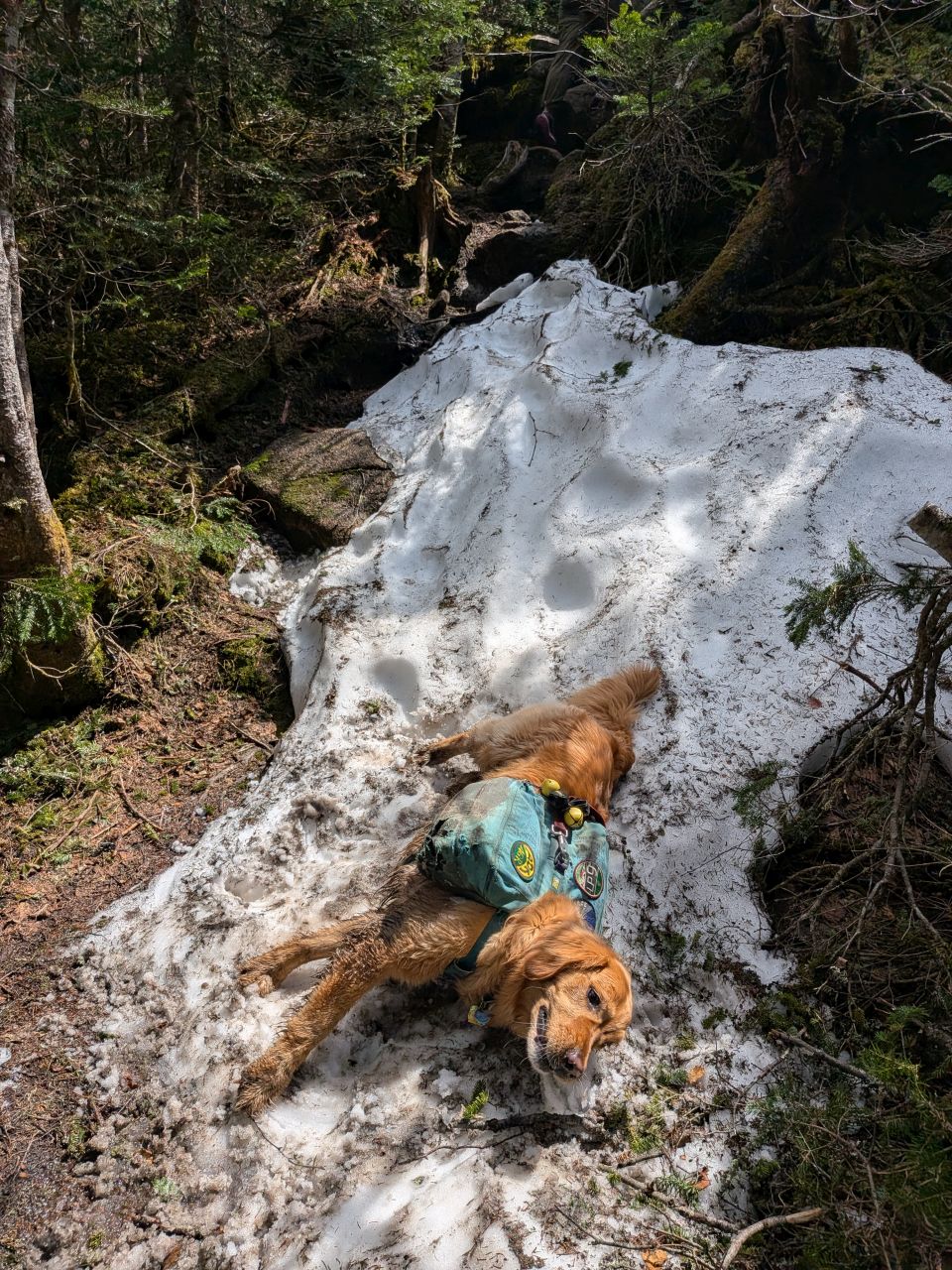
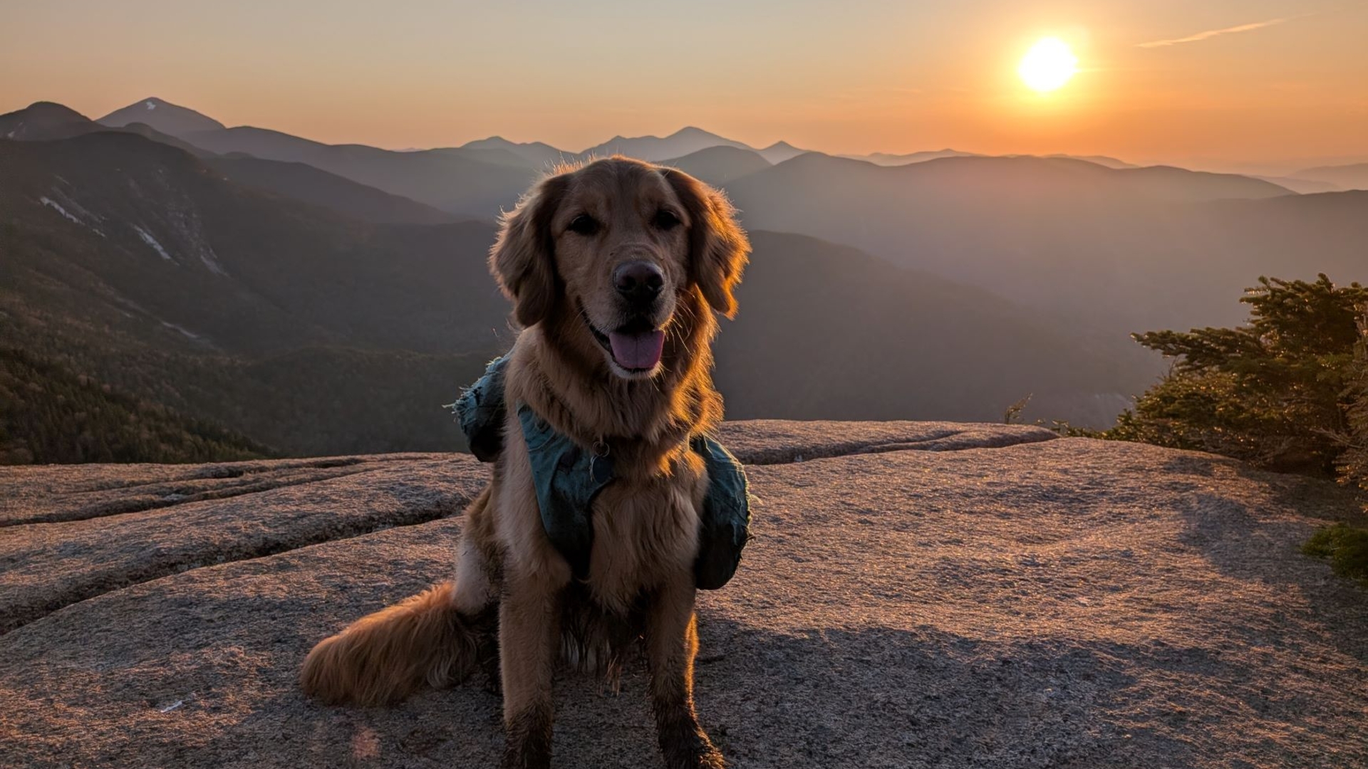
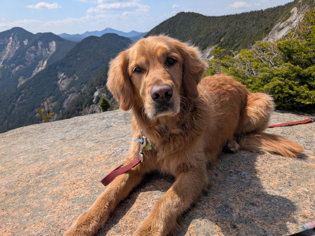
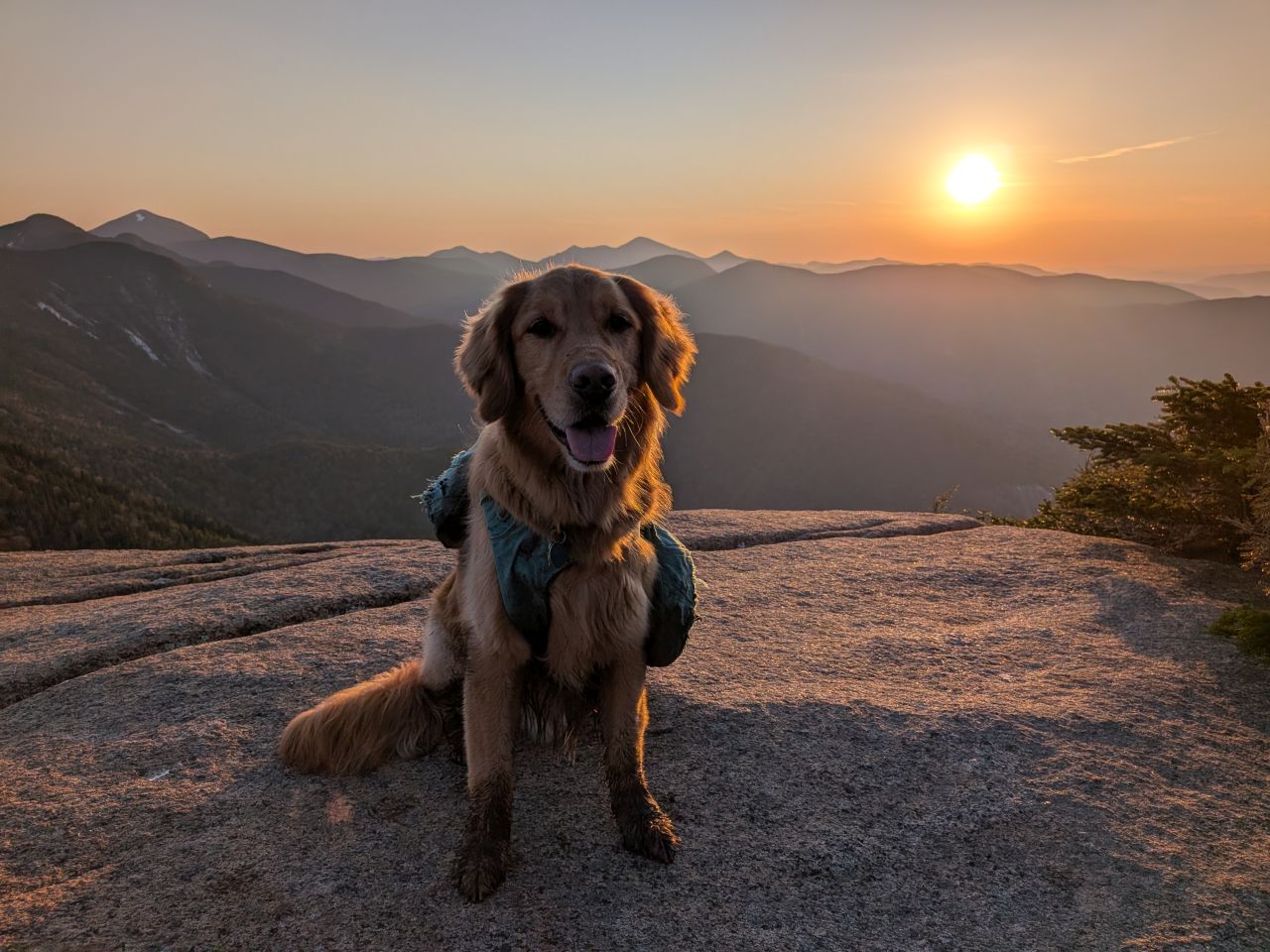
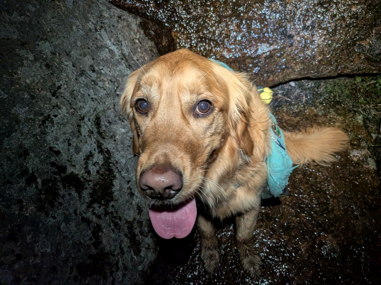
There was still a bit of snow in the shadowy areas throughout the hike. As usual, Sunny was absolutely loving it.

We summited Pyramid (elevation over 400' higher than Sawteeth) at 2:20. Nick, Stella, and Charissa didn't tarry long. As they set off, I reminded them to eat, drink, and rest as needed as they hiked off.
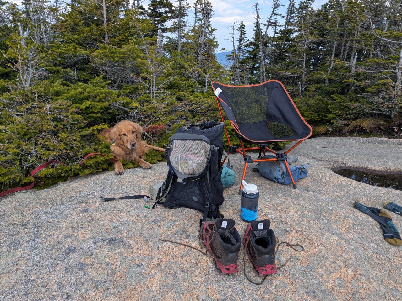
Knowing I had no intention whatsoever of climbing Sawteeth ever again, I'd brought my relax-a-chair. I took off my boots and socks to let them dry out and I took off Sunny's pack. Comfortable in the sun, we both lounged, the warm wind not only refreshing us, but keeping many of the bugs away.
Although I did feed Sunny a second helping of his special hiking food, he still wanted my snacks.
There are worse things than spending 3 and a half hours with this view. During that time, I dozed, listened to an audiobook, and chatted with Wendy over the phone. I warned her that it was looking a bit more like 1:30am rather than 10:30pm which I'd said the last time I talked to her.

Meanwhile, the other adventurers were claiming Sawteeth!
Chasing Sunset
They arrived back at Pyramid by 5:50 where they needed a decent meal and more electrolytes. It was getting late, but staying fueled and healthy is more important than worrying about when sunset drops, especially when conditions are just about perfect and you have plenty of dry gear to change into.
After a 30 minute break, I waved goodbye to the AMR in the distance and we headed off back to Gothics.
We hit the true summit of Gothics by 7pm. Sunset would fall in an hour and a half. I toyed with the idea of descending back down Gothics but I didn't relish the possibility of doing so in the fading light.
For elevation gain remaining, we only had a barely perceptible climb up Armstong, 200' up Upper Wolfjaw, and a gentle 100' climb up to UWJ's Northern false summit. After the day we'd had, this seemed reasonable. Our main concern at that point was hitting the Armstrong ladder before sunset, so we didn't tarry on Gothics for too long and headed up the ridge.
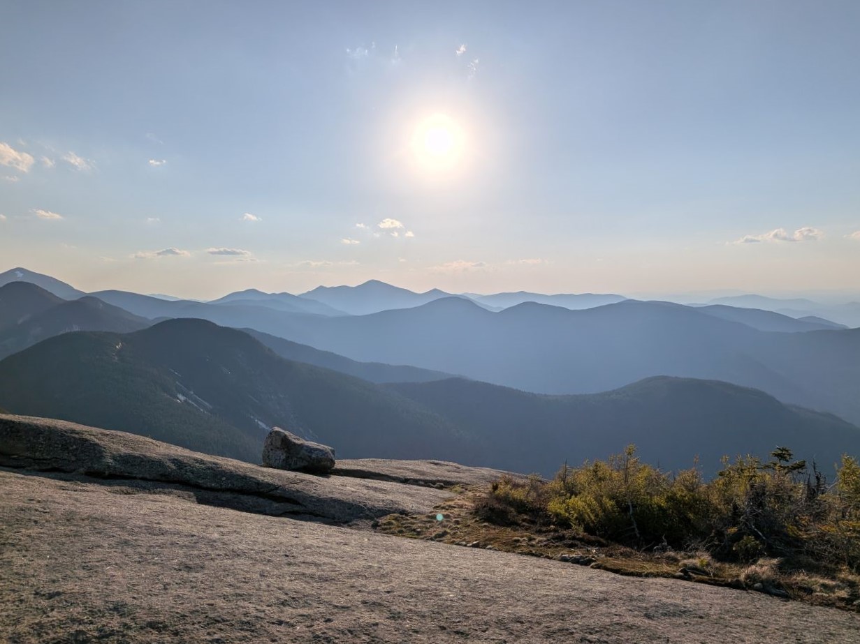
The view down the Northern Great range was absolutely gorgeous that night. Despite the fading light, the breeze out of the West was warm and welcome. It was such a perfect evening that it was easy to forget the aches and pains of age combined with strenuous activity.
We found some rotten snow and some mud along the ridge. People say this is supposed to be "mud season". However, the mud today didn't seem much better or worse than it usually is in the Adirondacks. Nick actually commented that it seemed fairly tame. I had a hard time disagreeing. Having said that, it's possible that we are suffering from Stockholm syndrome, having become used to the conditions here over the years.
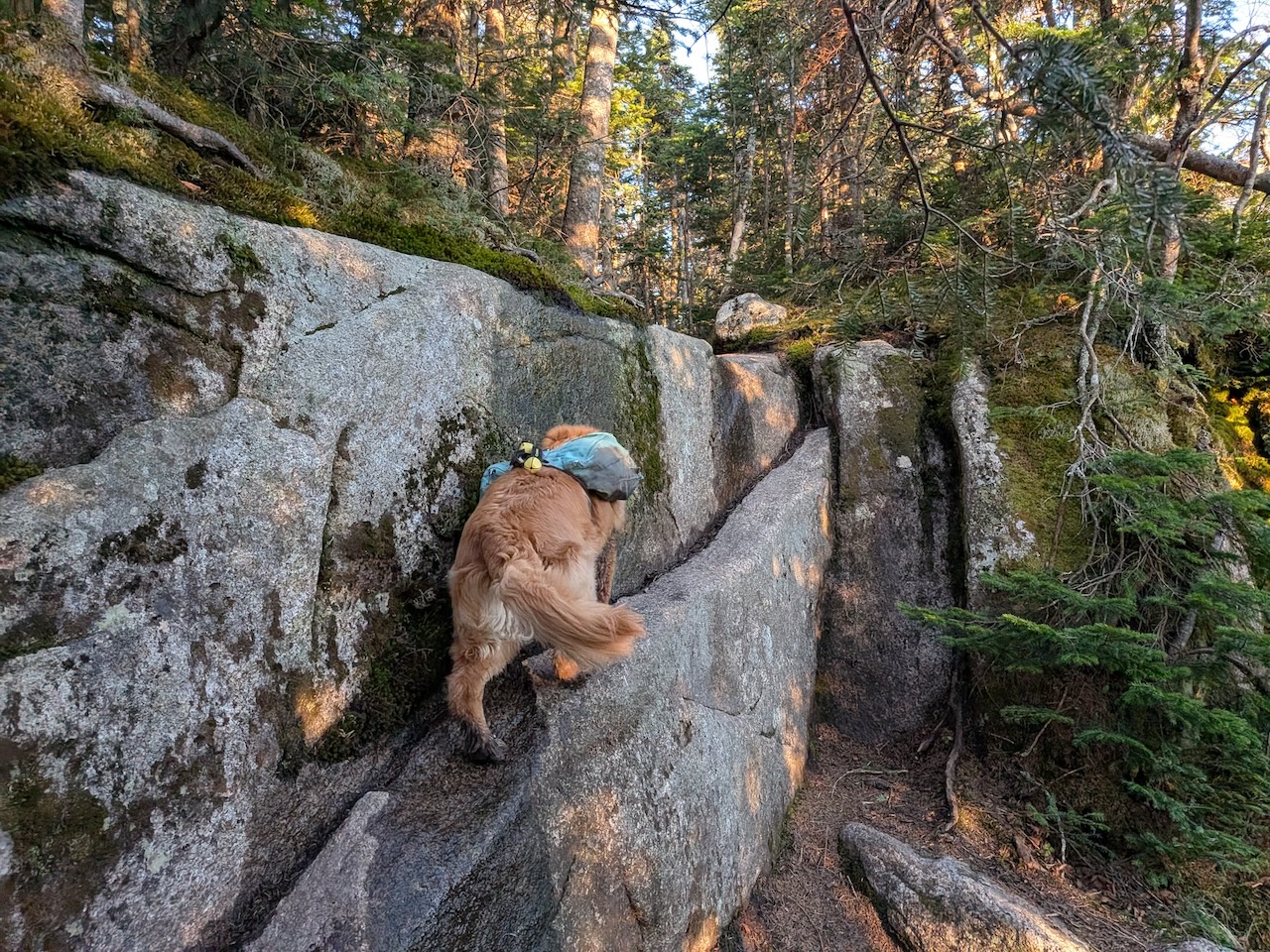
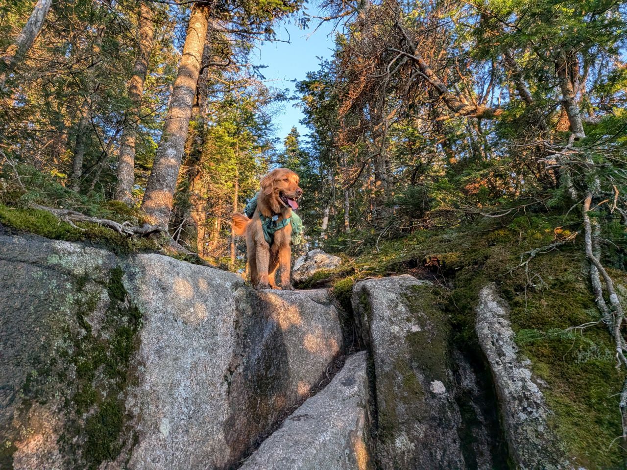
Sunny did a great job traversing The ledges along this section. I'd been a little worried about his abilities, having just passed the age of five. He is in great shape and has been pretty active but earlier in the hike he'd had some issues traversing some of the slabs. However, as we tackled the endless ledges across Armstrong and Upper Wolfjaw, I realized it was probably just him getting his mountain feet back. Me too, actually. It had been so long since we'd hiked a proper high peak without the crutch of big snow drifts that it had taken a little while to regain our muscle memory.
We arrived on the summit of Armstrong before 8:00 p.m. We were actually feeling pretty great despite the lateness of the hour and how much work we'd done that day. We still had food, water, and electrolytes. What's more, the perfect conditions made it very easy to stay positive and put one foot in for the other.
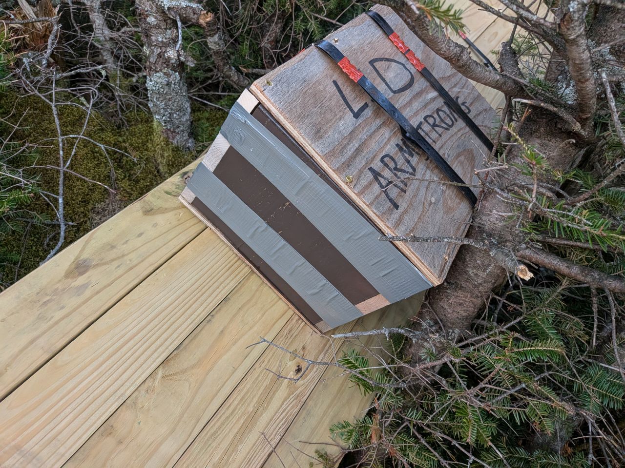
There was a bundle of building materials on top of Armstrong, sitting on top of foliage and partially blocking the trail. Is a very strange place for it. There had been bundles in other spots along the trail as well, including at the DEC interior Outpost. We figured they were going to be adding more ladders to several of the ledges on Armstrong and maybe Upper Wolfjaw.
Although being here at sunset wasn't strictly on purpose today, a sunset hike is definitely something that has been on my radar for a while. Tonight, it made for some absolutely gorgeous photos.
This one's a real winner. The photo too.
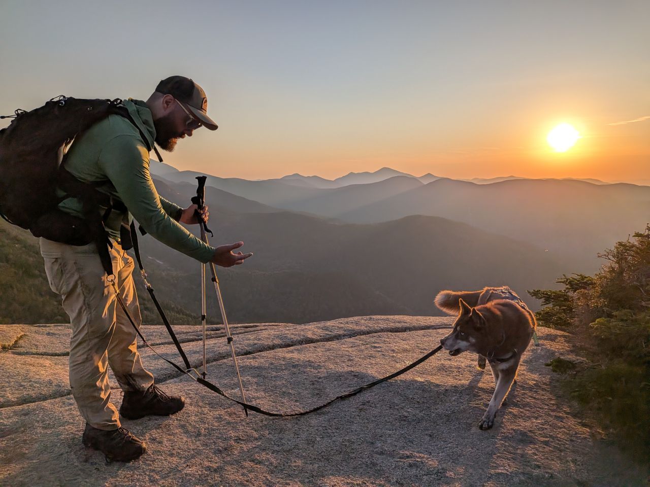
We caught a few more photos as we descended Armstrong, the sun slowly dipping behind the clouds and then the mountains. We did make it to the tall Armstrong ladder before sunset. I'd brought along Sunny's long cable lead to belay him down. I was especially concerned today because I'd heard the DEC had put in a new, steeper ladder which I knew for a fact Sunny could never climb down.
Experience once again proved useful. We formed a plan: I would climb down in order to coax him down the ledge while Nick and Charissa would belay him down. However, when I got to the bottom I noticed that the ledge actually tapered out to the left into the woods. There was still a bit of a jump but nothing that Sunny couldn't handle. In the end, I was able to direct him to the end of the taper where he jumped down easily on his own.
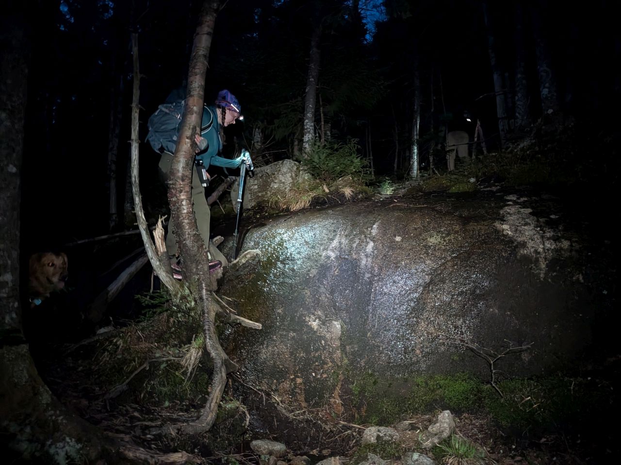
Hello Darkness My Old Friend
Night fell quickly as we approached the col between Armstrong and Upper Wolfjaw. It was at that point that we donned our headlamps. Nick was using his rechargeable Nitecore which handled the next six hours without issue. Charissa's Black Diamond shined poorly until she replaced the batteries, then it worked great. I had a cheap Energizer lamp with fresh batteries that started fading after 4 hours, but still took me to the end. I did have another fresh set of batteries but I didn't want to waste them if I didn't have to.
The climb to Upper Wolfjaw was rather uneventful, reaching the summit a few minutes past 9pm. Here we drained our water and had another snack before setting off across to the false summit. It was a very gentle climb and it was about 9:50 when we started the long and arduous descent to the col, Wolfjaw Notch.
The descent was long and difficult. I remembered it that way, but it was another thing to experience it again. Many of the slabs are tough to negotiate when wet, especially for short people. The trail is a stream. The soil and vegetation are absolutely tortured. Some ladders here would absolutely help reduce erosion and make this a safer route.
The good cheer was draining somewhat, but I was determined to keep a steady pace and stay safe.
We did eventually make it to the col where I took a bio and a breather while my friends continued on to find the water source.
When we met back up, I refilled a couple of liters and added an electrolyte packet to one. I went through three packets that day. Although I was tired, my food and hydration game had been on point all day. As such, despite the arduous march ahead of us, I was in fairly good shape. It might help that I'd had a rest instead of climbing Sawteeth.
It was a very long 5 mile hike back to the car. AllTrails tells me the march home progressed at 33 minute mile split pace and, considering the 20 hours, 17 miles, and 4300' of gain (19 and 5600' for Nick, Charissa, and Stella) I'm going to call that "not bad". At some point I decided to re-leash Sunny to keep him out of the nocturnal animals; skunks, porcupines and the like. After the Interior Outpost junction, Nick jumped ahead with Stella to get her to the car and resting.
I had a tough time for the last three or four miles, annoyed at being tethered to the dog and the moths dive-bombing my face. I was quite cranky to the point where I had to unleash Sunny again. Several times I had to shut off my headlamp just for a short reprieve from the swarming insects.
About two miles from the car, Sunny suddenly jumped out ahead and stood stock still. I immediately recalled and re-leashed him. I figured there were deer out there. Wouldn't be the first time.
A few moments later, Charissa asked "Is that Stella?" I looked up and saw a pair of wide-set orange circles gleaming back at me. I hollered Stella's name, but the eyes stayed on us. As we drew nearer, passing to the left of the animal, they followed us with their eyes, only turning once or twice. When the animal turned its head, both eyes disappeared, solidifying our thought that it wasn't a deer. Charissa pulled out her bear mace just in case as we walked by, making a racket with multiple "Hey bear!" calls. It just quietly watched us from the dark until we were gone.
Nick said he and Stella had seen a deer when they ranged ahead of us. However, because of the circular, wide-set, orange appearance of they eyes, we are pretty sure it was a bear, especially after looking up photos online the day after. An ADK trailhead Steward at The Garden last year had told me that a bear had been sighted in that area, but I'd been dubious, wondering if the warning had been a ruse to encourage good behavior. I guess he wasn't lying.
The end of another long but rewarding day
We arrived at the trailhead at 2:50am. I immediately took my shirt and boots off and relished in the cool night breeze. Nick and I said our goodbyes to Carissa and started the long drive home. We did pass a car of hikers driving up the road to the trailhead as we were leaving and that made me laugh. I'm sorry to say I did fall asleep on Nick a couple of times, for which I apologize profusely.

That was a big day in the woods. It was a bit of a combination of the Pinnacle Traverse hike and the Santanoni range. Pinnacle had been longer than this, but I'd felt mostly fine the entire time, at least until the moths started bothering me. With the Santanonis, the hike was shorter, but we'd been so fatigued I'd wished we could just stay one more night in the lean-to. For this hike, despite feeling okay, a night at the lean-to would have meant a safer drive home.
As always, pain is temporary and the sense of pride and accomplishment lingers. I'm looking forward to the next hike despite the already busy Summer we have coming up. I'm definitely looking forward to joining Nick on his and Stella's 46er finisher and joining Charissa on more of her adventures.
Route Map

All_day_on_the_Lower_Great_Range.gpx (646.39 KB)